|
Area: 78,651 hectares
|
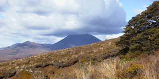
A spectacular alpine park with 3 active volcanoes - Mt Ruapehu, Mt Tongariro and Mt Ngauruhoe. Lava flows, active
craters, hot
springs, lakes, grasslands, forest and alpine herbfields. World Heritage Area.
Well-developed facilities enabling easily accessible year-round walking and tramping, winter skiing, mountain, ice and rock climbing. |
|
| Among the many walks available to the visitor, the
Tongariro Crossing is one of the most popular. Shuttle drop off and pick
up make the trip an enjoyable day in a unique volcanic environment. |
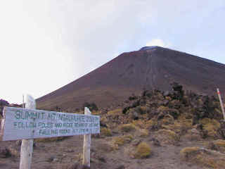
Only the most energetic ones will go up Mount Ngaururoe, the ascension
adds at least 2h to the trip.
|
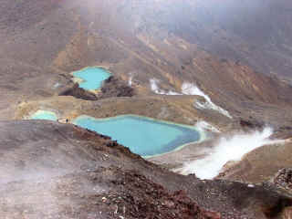
Emerald Lakes
|
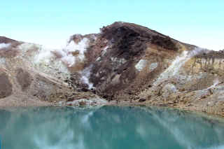
Fumaroles
|
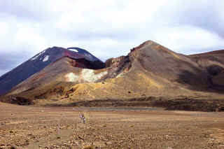
Red Crater in front of Ngaururoe
|
|
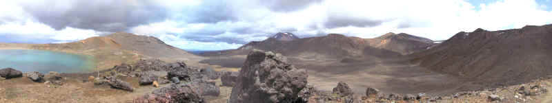
Tongariro volcanic plateau panorama
|
| Tongariro
National
Park |
|